Sunday, June 2, 2013

Queensland: crocodile creek

It's not really called Crocodile Creek; it's called the Dickson Inlet, and it's a mangrove lined tidal estuary that's upstream from the Port Douglas marina. It does have crocodiles, though. We took a sunset cruise up Dickson Inlet on our last evening in Port Douglas.


When cyclones are approaching, people take their boats inland, up the inlet, to protect them from the storms. Not always successfully, as the boat below shows! This yacht couldn't be salvaged after a cyclone, as the salvors couldn't board the boat -- because a large crocodile had taken up residence nearby. So the yacht was never salvaged and here it lies today. Crocs 1, salvors 0.


Our first croc sighting was this large male. Can you see it in the middle of the photo, close to the bank, just under the water?


A bit further up the river, we saw another crocodile: this time a female crocodile who most obligingly walked out of the water, turned around on the bank like a reptilian ballerina, and then disappeared back into the water. Perfect timing for us, but quicker than you think, so photos were a bit difficult. These are taken on zoom and with the movement of the boat, focus was a bit challenging.


We saw fish eagles and kites, both of which responded to salmon heads offered by the tour guide. (Apparently the fish eagle scorns all offerings other than salmon.) 


 And back into Port Douglas marina, just a couple of hundred metres away from the crocs.


Sunday, May 19, 2013

Namibia: Sossusvlei

23 1/2 degrees south of the Equator, the Tropic of Capricorn passes though Namibia.


We stopped at Solitaire on the way from Walvis Bay to the Namib Naukluft Park, for tea and for Moose's famous apple tart.

Moose making his famous tart. Not sure which is bigger ... Moose or the apple tart!!??


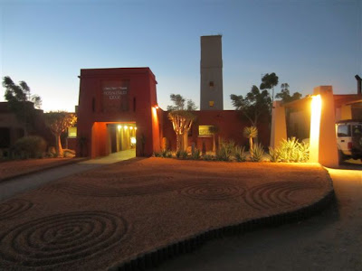
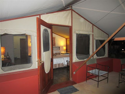
Sossusvlei Lodge is situated 330 km south west of Windhoek on a 40 000 hectare private reserve in the Namib Desert.


Namib Naukluft Park has some of the highest dunes in the world's oldest desert. Sossusvlei is surrounded by monumentally high dunes, with sinewy crests and warm colours changing as the day progresses. The warm tints of the sands range from apricot to orange, red and maroon and contrast vividly against the dazzling white surfaces of the clay pans at their bases.


Hiking down Sesriem Canyon, close to Sossusvlei, where centuries of erosion have cut a narrow gorge about 1 km in length and 40m in height. Sesriem derives its name from the time when early pioneers tied 6 lengths of rawhide thongs together to draw water from the pools.


Thursday, May 16, 2013

Namibia: Walvis Bay

Our quad bike historical tour into the desert was undoubtedly the highlight of our trip!

We chose the prehistoric Kuiseb River and dunes just outside Walvis Bay, which are older than the Namib Desert (the oldest desert in the world).


Do you know that the gradient of a dune slip face is 34 degrees and it never differs no matter what the size of the dune is?


Physical evidence of petrified footprints of the ancient Khoi.


This desert fruit is called !Nara and is used by the Topnaars (descendants of the ancient Khoi inhabitants) as well as by the animals.


Evidence why the Namibian coast is called the “Skeleton Coast”. These old skeletons of the ancient Khoi people are exposed and covered again, from time to time by the ever shifting dunes.


Centuries-old ostrich eggshells that were used by the Khoi to keep their water in and have been preserved, being covered by dune sand for centuries.


A Topnaar (descendants of the Khoi) home in the dunes. These people, who today still live their traditional lives in the dunes and whose whole life centres around one desert fruit. They have no money, no electricity, no mobile phones and no motor vehicles. They prefer not to live in town with its amenities.


The magnificent flamingo flocks of Walvis Bay.